Curated OER
Geography Journey
Fourth graders examine the geographic features that define places and regions and answer questions about the state of California. They discuss the components of a map legend and answer worksheet questions using a map of California as a...
Curated OER
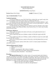
Indiana Travel Guide
Fourth graders, after exploring and researching the state of Indiana, create a travel guide about the state of Indiana including its capital, major rivers, governors and two famous people from the state. They utilize a variety of art...
Curated OER
Our 50 States
Students identify the location of the 50 states using an interactive map. They practice geography skills by playing a fun game. Pupils become familiar with the state abbreviations for the US states. Students become familiar with the...
Curated OER
Directions, Directions
Third graders review cardinal directions, moving around the room so that they are standing in the part of the room that is nearest the north, south, east and west. They are asked what would you do if they are lost? Pupils work as a...
Curated OER
Compass Rose
Second graders practice identifying the four cardinal directions. After locating a compass rose on a map, 2nd graders explain each point that corresponds to a direction. Using a toy ship as a manipulative on a map, students observe its...
Curated OER
Read a Map ... It's a Snap!
Students are introduced to map and globe skills. They use grids and are able to construct their own simple maps of familiar places. Students are able to define a map, globe, and symbol and use the direction words north, south, east,...
Curated OER
Community Building
Seventh graders discover the similarities and differences between cities, towns, and rural communities. Using a Neighborhood map Machine, they create a Venn diagram and map of their own community. Students build a 3-D representation of...
Curated OER
Mapping the Library
Learners compare their school library with another library such as: town library, for example, or a virtual library and identify the most important features. Students use their observations to create a map of the school library that can...
Curated OER
Mush! Tracking Travelers on the Trail
Students get to know Alaska and the Iditarod route that is run by dogs as they track the mushers' progress on a map that they create specifically for the race. They learn about latitude, longitude, plotting on a map, checkpoints, and...
Curated OER
TE Lesson: Habitat Mapping
Students examine the current technologies used in mapping resources in the marine environment. They look at remote sensing, sounding, and underwater vehicles. They examine image from the benthic habitat produced by the GIS in order to...
Curated OER
Tracking Fall's Falling Temperatures
Young meteorologists track weather from day to day and record results on graphs, maps, or other places. They see firsthand how weather temperatures trend cooler as fall progresses and practice grade-appropriate skills in geography (map...
Curated OER
Making Maps
First graders create a map of their classroom that can be used to find a hidden treasure. They examine two- and three-dimensional objects and discover characteristics.
Curated OER
Make a Classroom Map
Students map the items in their classroom to explain the importance of coordinate systems.
Curated OER
Creating Station Models
Young scholars review weather conditions at various cities and create station models on a weather map.
Curated OER
Create a Country
Students work in small groups to list features and elements found on a variety of grade- appropriate maps. They develop a class list of map features and elements to draw from as they create a map of an imaginary country.
Curated OER
How Many Ways Can You Say Merry Christmas?
Students create a multicultural holiday bulletin board map! students research and study saying Merry Christmas in different languages. They correctly locate the countries on a world map.
Curated OER
Geography Booklet
Sixth graders explore geography terms. Students use resources to find real examples of landforms in the world. They create a map showing the landform. students label the surrounding features, countries and states. Students use each...
Curated OER
Name That Town
Students explore geographic locations and locate towns on a map using map coordinates.
Curated OER
Salad Tray 3D Topographic Model
High schoolers explore the characteristics of topographical maps. They examine the relationship of contour lines and vertical elevation. Students create a three-dimensional model of a landscape represented by a topographic contour map.
Curated OER
Photosynthesis Concept Map
In this photosynthesis worksheet students complete a venn diagram of the process of photosynthesis by choosing from a list of terms and phrases.
Curated OER
Is there a map in that story?
Eighth graders examine different pieces of literature from specific isolated Pacific islands. In this Geography lesson, 8th graders read and interpret a written selection. Students construct a map of the stories setting.
Curated OER
Eratosthenes
Students examine what Eratosthenes is and the history behind him. In this earth lesson students complete a hands on activity to repeat Eratosthenes' experiment.
Curated OER
States On A Map
Third graders locate the states of Main and Kansas on a map. In this state location lesson plan, 3rd graders read the book Sarah, Plain and Tall and discuss what states she traveled through.


