College Board
2004 AP® Human Geography Free-Response Questions
Human geography involves everything from why people build factories along the United States-Mexico border to how land-use patterns and demographics are related. So, how do test-takers put it all together? Focused questions from an AP...
College Board
2011 AP® Human Geography Free-Response Questions
How have Mexico's largest cities help shape the destiny of that country? What insights can a ninteenth-century economist give us about population growth? Two essay-style questions help your learners unravel complicated relationships....
Richmond Community Schools
Map Skills
Young geographers will need to use a variety of map skills to complete the tasks required on this worksheet. Examples of activities include using references to label a map of Mexico, identify Canadian territories and European countries,...
NASA
Outline Maps
Don't miss this gold mine of blank maps for your next geography lesson! Regions include traditional continents such as Asia, Europe, and Africa, as well as other major world areas such as the Pacific Rim and the Middle East.
National Museum of the American Indian
The A:Shiwi (Zuni) People: A Study in Environment, Adaptation, and Agricultural Practices
Discover the connection of native peoples to their natural world, including cultural and agricultural practices, by studying the Zuni people of the American Southwest. This lesson includes examining a poster's photographs, reading...
Teacher.org
Christmas Around the World Part 1
A creative lesson plan shines a spotlight on Christmas celebrations throughout six different countries. Scholars read an informative text and share their new-found knowledge with their peers. After hearing about each country, pupils...
Concord Consortium
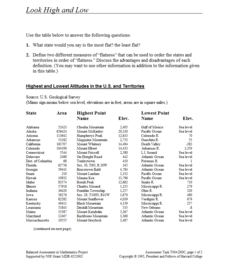
Look High and Low
From the highest high to the lowest low here's a resource that won't fall flat. Given data on the area and the highest and lowest elevations of each of the 50 states, learners decide which states are the least flat and the most flat. Of...
University of New Mexico
Let's Travel
Fourth graders work in groups to research various locations across the United States. They present their findings to the class, participate in a travel fair, make phone calls to tourist agencies and write letters to state tourism...
Other popular searches
- Mexico Geography
- New Mexico Geography
- Mexico Geography Map
- Cultural Geography of Mexico
- Mexico Culture Geography
- The Geography of Mexico
- Physical Geography of Mexico
- Teaching Geography of Mexico
- Making Physical Maps Mexico


